Grace Stonecipher

Spatial Analysis, Data Visualization, Conservation
Email Me
View My LinkedIn Profile
Portfolio
Spatial Analysis
Script: Potential Impacts of Linear Infrastructure on Biodiversity in 28 Asian Countries
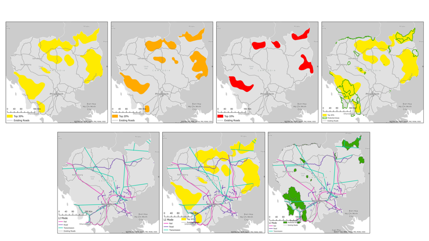
Written for the Center for Large Landscape Conservation as part of the Linear Infrastructure Safeguards for Asia Project
Skills Used: Python (ArcPy), ArcGIS Pro
Spatial Analysis: Mitigating Impacts to Wildlife During the Expansion of National Highway 37 in Assam, India
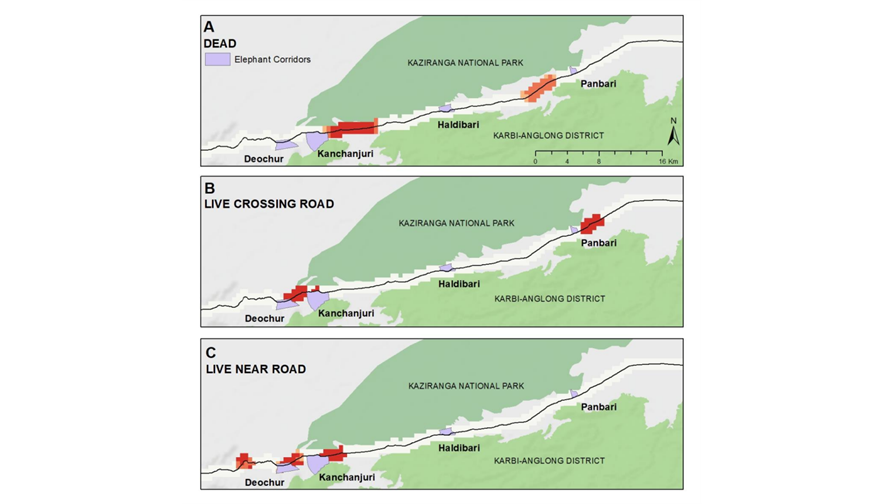
Written for the Center for Large Landscape Conservation as part of the Linear Infrastructure Safeguards for Asia Project
Skills Used: ArcMap (optimized hotspot analysis)
Spatial Analysis: Potential Impacts of Planned Paved Roads and Railways in Mongolia on Khulan and Goitered Gazelle
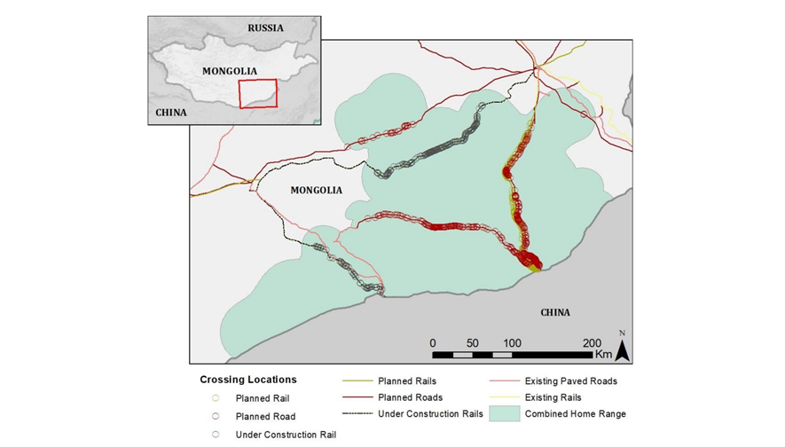
Written for the Center for Large Landscape Conservation as part of the Linear Infrastructure Safeguards for Asia Project
Skills Used: R, ArcMap
Web App: Restoration Planning Tool
Code
Presentation
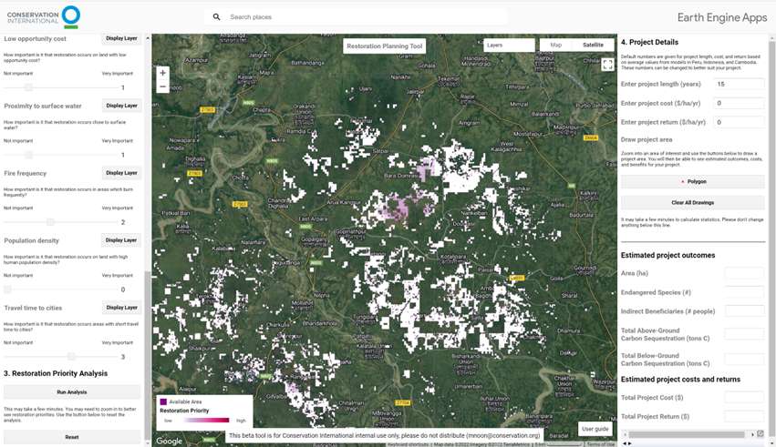
Written for Conservation International
Skills Used: Google Earth Engine, Javascript
Jupyter Notebook: Pacific Crest Trail Planning App
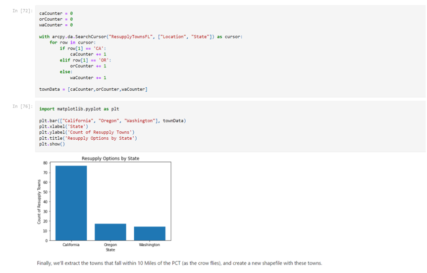
Written for Penn State University GEOG 489: Advanced Python Programming for GIS
Skills Used: Python, Jupyter Notebooks, ArcGIS API for Python, ArcGIS API for Javascript
Jupyter Notebook: Mapping the Impacts of a Windstorm in Lewis & Clark National Park Using Multiple Change Detection Methods
Written for University of Wisconsin-Madison ENVIR ST 956:
Skills Used: Python, Jupyter Notebooks
Mapping
Visualizing Impacts to Wildlife Along NH-37 in Assam, India
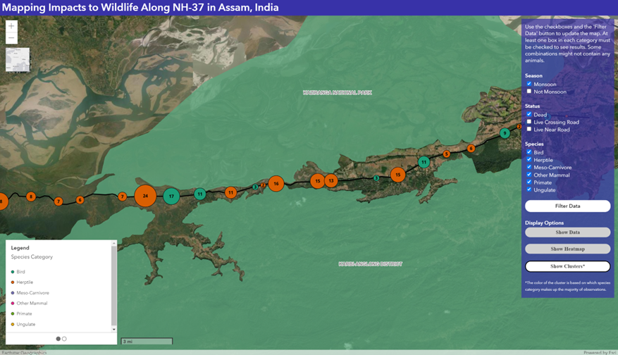
Built for Penn State University GEOG 863: Web Application Development for the Geospatial Professional
Skills Used: Javascript (ArcGIS API for Javascript), HTML, CSS
Visualizing Overlap of Linear Infrastructure and High Biodiversity Areas in the Mekong Region Using Open-Source Mapping Tools
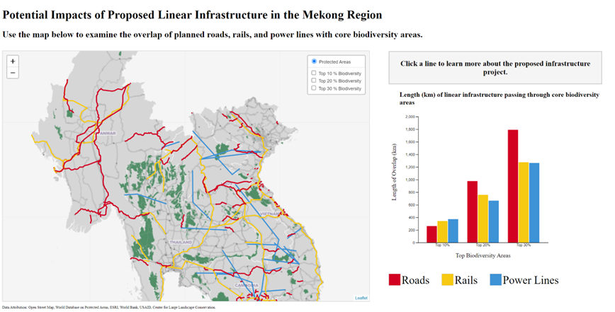
Built for Penn State University GEOG 585: Open Web Mapping
Skills Used: Tilemill (custom basemap creation), Leaflet, QGIS, OGR, GDAL
StoryMap: Using Remote Sensing to Examine the Great Coastal Gale in Coastal Oregon
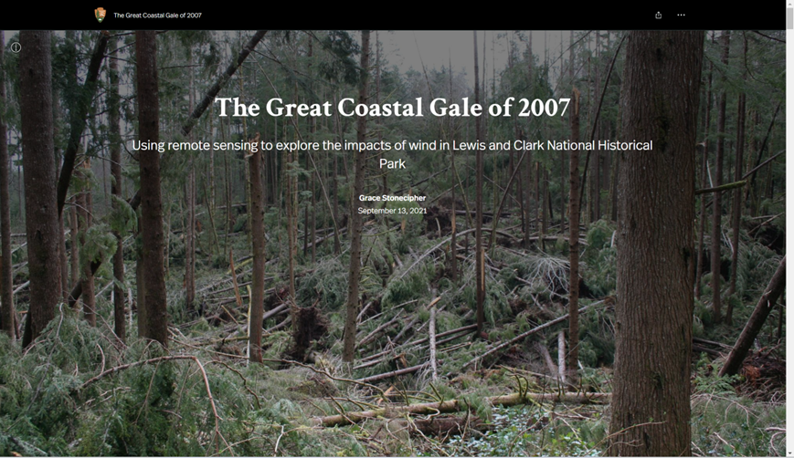
Built for the National Park Service
Skills Used: ESRI StoryMaps, ArcMap, Google Earth Engine
Map: Public Lands in Wisconsin
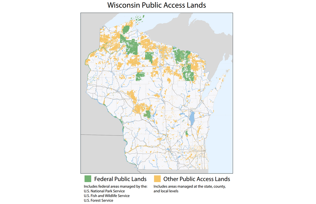
Built for the University of Wisconsin-Madison Nelson Institute of the Environment 2019 Jordahl Lecture
Skills Used: ArcMap, Adobe Illustrator
Writing
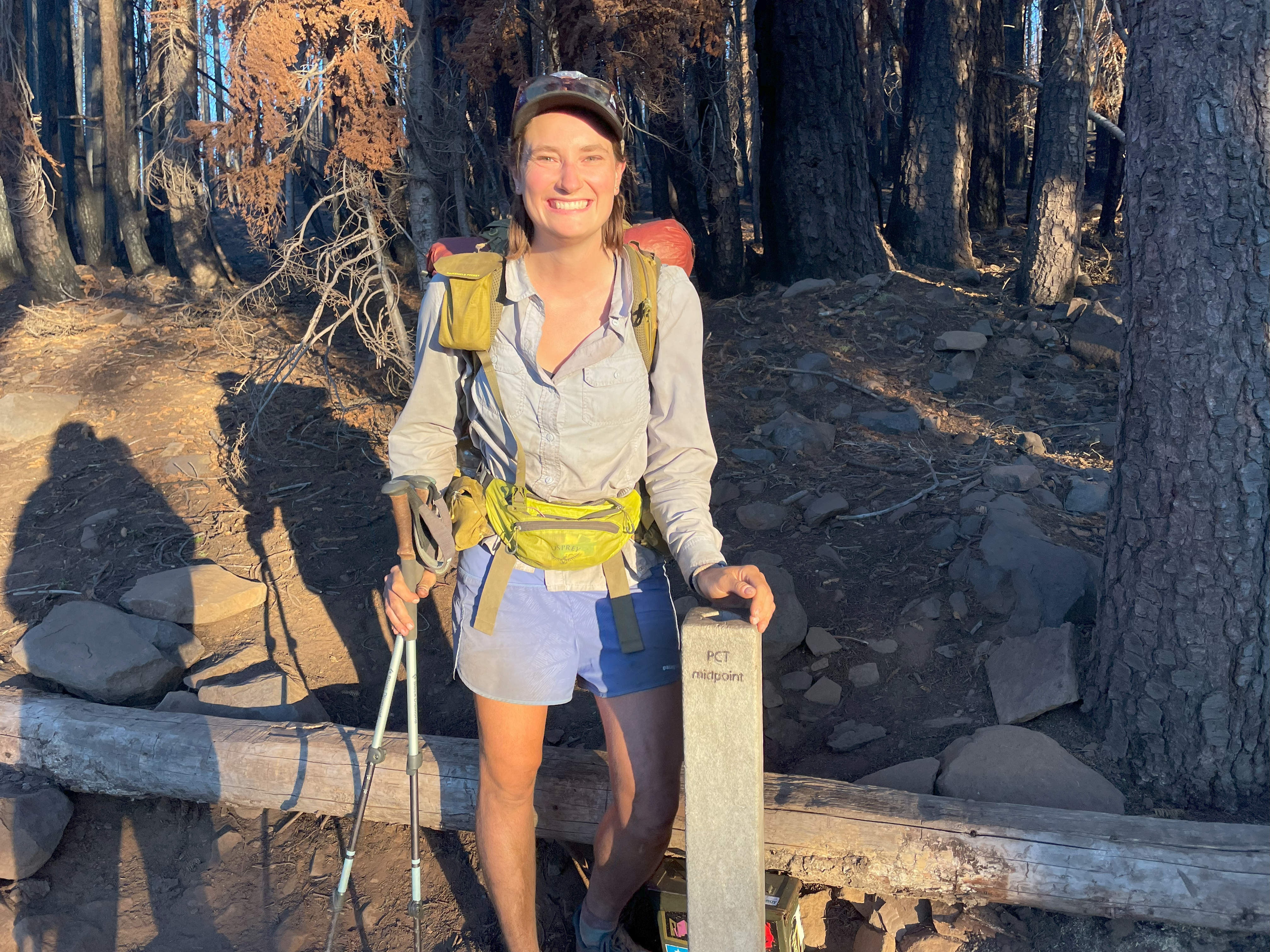
Blog: Grace Hikes the PCT - A Big Walk Along the Pacific Crest Trail
Page template forked from evanca